Brief History of Newcastle Parish


This article has been compiled using Lewis’s Topographical Dictionary of Ireland 1838 (Lewis), the Irish Tourist Association Surveys 1943 and other sources. These valuable historical records are stored in the Local Studies Collection of Wicklow County Council Library Service and can be viewed by appointment.
Newcastle is a barony and a civil parish consisting of Newcastle Upper and Newcastle Lower. According to Liam Price the parish of Newcastle was a portion of the ancient territory of Crioch-Cualan, or Hy-Briun-Cualan which extended from south county Dublin into the Wicklow coastal lowlands as far as Newcastle.
Medieval Settlers
In Anglo-Norman times (circa 1100-1300) inhabitants of villages such as Newcastle were offered favourable conditions as tenants. These villages attracted settlers who were offered ‘burgage plots’ and were given protections and privileges.
Burgage plots were a type of medieval allotment; long and narrow plots of land were situated at the back of, and the same width as, street-facing properties. The burgesses (inhabitants of a town with certain privileges) in Newcastle complained of serious devastation by the local families and they were so often burnt that they could hardly live there –Wicklow History and Society.
The Castle
Newcastle takes its name from the ‘castle’ (which still exists as a ruin) which was built to protect the settlement from the O’Tooles’ and the O’Byrnes’. Records show that the castle known as Novum Castrum McKynegan was connected with Edward 1st (1239-1307) and it was repaired in 1308 by Piers Gaveston who was Lord Lieutenant of Ireland in the reign of Edward 2nd (1307-1327) – Lewis.
This medieval structure has been considerably altered and is constructed of local uncoarsed stone with extensive red-brick additions. The remaining structure is a large gate-house with a massive barrel vault. On the Northern side there is a small chamber with a low groin vault. A small blocked doorway on the southern side indicates that a similar chamber lay on the other side. The steep staircase in the northern wall of the gate-way is a later insertion as it blocks a small doorway in the east wall. The doorway gave access to a small chamber, possibly a guard room. Fragments of badly decayed ‘tufa mouldings’ are also visible. The staircase leads to an overhead chamber probably contemporary with the gate-house but extensively re-modelled. The chamber displays a large seventeenth-century fireplace, a slop-stone, and three large windows. The southern chamber is mostly constructed of red brick as are the two upper storeys. An early date for the core of the building is suggested by the remains of the plank shuttering used in the construction of the barrel vault of the gate-way. The blocked doorway in the eastern wall may also suggest an earlier date. The size of the gate house suggests that the fortifications at Newcastle McKynegan were very extensive; little remains of the massive curtain wall which must have surrounded the castle precincts – Wicklow History and Society.
Extending The Pale
According to Lewis in 1595 Sir William Fitzwilliam, Lord Deputy of Ireland took control of several Wicklow lands from the O’Byrnes’ and O’Tooles’ as a part of his attempt to extend the pale south from Dublin during the nine years’ war (1594-1603). The plan was to extend the power of the central government in Dublin into east Wicklow and the valleys around Rathdrum making the O’Byrnes’ and O’Tooles’ move to West Wicklow. Nevertheless these local families were involved with the administration of the area and were connected with the English Royalty around the 16th century.
The castle which was a military station shows the importance of Newcastle as an important English town on the eastern side of the country before the area was ‘shired’ into the county of Wicklow in 1606. This area known as a manor was connected with the reign of Charles 1st from 1625 – 1649 and it subsequently was ‘parcelled’ out among several ‘patentees’ under the Act of Settlement in 1701 during the reign of King William. The Act of Settlement was passed to ensure the property succession rights of the Crown.
19th Century Newcastle
Later in 1837 according to Lewis in the North end of the village, there were the remains of a strong building, said to have been a gaol, court-house and the remains of two other castles. Cannon balls and skeletons were discovered nearby in the 1800’s.
In Lewis’s time:
“the soil, when dressed with lime or marl, yielded good crops of oats. Some of the finest veal and earliest lamb brought to the Dublin market was reared here. The long white early potato, called Bangors’ was extensively cultivated. The salt marsh of Cooldross, formed by the opening to the sea, was used in the recovery of horses. Turf was taken from the bog near the marsh.
A large part of the shore on the eastern side of the parish opens on to the sea, rendering the neighbouring lowland into a marsh; the land was intersected with deep artificial trenches, to prevent the floods from injuring the cultivated land.
The western limit of the parish is formed by a range of hills extending from Dunran to Drumbawn and the sea between which there is a fine tract of rich soil, highly cultivated, thickly planted and studded with numerous mansions, villas, demesnes and parks”.
The parish contained several villas and seats (residences of important families) some of which remain and these include:
Woodstock which was the residence of Lord Tottenham – Bishop of Clogher which is currently known as Druids Glen
Mount John which was the ‘seat’ of Graves Chamney Archer which is still standing
Killadreenan which was the ‘seat’ of Alderman Charles Archer, overlooking the glen of Dunran
Seamore Lodge was the‘seat’ of John Leonard which employed a fine view of the Sugar-loaf and Bray Head
Lower Newcastle ‘seat’ of James Jones which contains an old fortification called the Garrison
Upper Leabeg ‘seat’ of John Gray
Leamore seat of John Smith where several skeletons of the heads and horns of large moose deer were found on the land in a bog
Cooldross seat of W. Webster
Leabeg seat of W. Ashenburst
Kilmullen seat of Thomas Halbert The parish of Newcastle contained a lay rectory and a vicarage in the diocese of Dublin and Glendalough.
The glebe-house was annexed to the vicarage. There was a chapel of ease (church other than a parish church), being built at the time of the Lewis’s writings and this was known as St. Matthews and was dated 1835. At Kiladreeny (‘Kiladreenan’) there were the ruins of a large old church and an in use cemetery.


Comments about this page
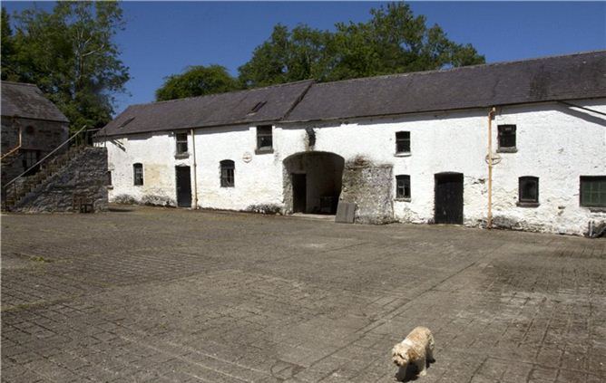
Newcastle House is dated in this article as 1800 – 20; in fact the house was badly burned in the fighting during the 1798 rebellion and records of a repairing lease dated 1801 entered into by a Captain Reville are in the Coollattin archive. The house was probably built c 1750.
Mary,
A mighty fine history. Would you know anything about a stretch of nearby coastal land that was known as the Giant’s Bed?
Regards
Roy Stokes
Add a comment about this page